
What Makes Drone-Based Surveys More Accurate Than Traditional Methods?
Traditional land surveying is a grind. For decades, crews have gone out with tripods, total stations, and machetes, hacking through brush to take points one by one. It works, sure. We built cities that way. But it is slow, and it leaves huge gaps. If you take a measurement every fifty feet, you are just guessing what happens in the forty-nine feet between them. That is where errors crawl in. When you miss a sudden dip or a hidden mound, your whole volume calculation goes off. It is frustrating, expensive, and completely avoidable now.
Drones change the entire game. Instead of catching a few hundred points over a long, sweaty week, a drone captures millions of points in a single afternoon. This massive jump in data density is the real secret behind modern Drone survey accuracy. You are no longer guessing what the ground looks like between crew stops. The drone sees everything. Every rock, ditch, and slope gets recorded down to the centimeter. It gives you a perfect digital copy of the dirt, which means your designs and dirt-moving math actually match reality.
The Magic of Modern Aerial Mapping
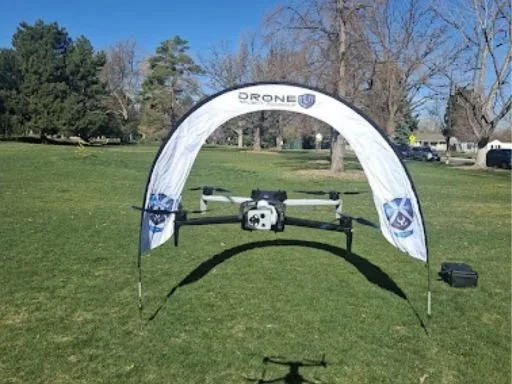
The tech packed into these flying cameras is wild. These are not kids' toys. Advanced commercial drones use high-res cameras and smart sensors to assemble pretty detailed maps. Through a process called photogrammetry, the software stitches thousands of overlapping photos together, sort of like it’s weaving a fine tapestry. This high altitude workflow, generally known as Aerial Mapping, builds an exceptionally detailed 3D model of the project site, and it’s not just “pretty”, it’s actually useful. You end up with a bird 's-eye view that a ground crew just can’t replicate, no matter how diligent they try.
Then you have RTK and PPK tech. These are real-time GPS correction systems built right into the aircraft. Traditional surveyors spend hours setting up physical ground control points all over a site just to keep things accurate. With automated flight corrections, drones can fix their own location data mid-air on the fly. This makes UAS surveying incredibly fast and consistently precise. You get dead-on measurements without wasting half your morning hammering stakes into hard clay or dodging heavy construction traffic.
Why Traditional Methods Fall Short on Complex Land Surveys
Think about the places that are toughest to measure. Steep highway slopes, active quarries, or dense swampy forests. Sending a human up a crumbling gravel pile with a GPS rover is a safety nightmare. It is also slow as molasses. This is exactly where old-school tech fails. When a site is too dangerous or rough, ground crews naturally take fewer points to save time and stay safe. But fewer points mean worse data, and worse data means mistakes during the actual construction phase.
Drones do not care about steep cliffs or muddy swamps. They fly right over the top without breaking a sweat. Using Aerial survey technology allows teams to gather perfect data from a safe distance.
Confused about hardware?
Choosing the Right Hardware: Skydio Mapping Drones vs Fixed-Wings
Not all aircraft are built the same way. The type of site you have dictates the tool you need. For tight, complex environments or spots near heavy infrastructure, multi-rotor systems are king. For instance, autonomously guided Skydio mapping drones do pretty well at flying close to obstacles, capturing vertical structures, and then dodging trees with no human intervention at all. They’re almost ideal for narrow utility corridors or busy construction zones where you need 360-degree obstacle avoidance so the equipment stays safe and sound.
On the flip side, if you are looking at thousands of acres of open farmland or a massive pipeline stretch, you need endurance. That is where long-range vertical take-off Wingtra drones come into play. Matching the right drone to your specific job style is how you keep your accuracy high and your field costs low.
Smart Software Beats Human Mistakes
Humans get tired. After eight hours walking under a hot sun, anyone can misread a numbers grid or skip a tough slope. Drones do not get tired, bored, or distracted. They follow an exact pre-programmed flight path down to the inch. This disciplined approach makes modern drone mapping incredibly reliable.
Once the photos land in the processing software, the computer handles the heavy lifting. It identifies matching pixels across thousands of images to build a dense point cloud. This digital approach to Drone land surveys gives engineers a rich dataset they can slice, spin, and measure from their office desks. You can re-check a measurement weeks after the flight without sending anyone back out to the site.
Expanding Into Commercial and Public Safety Work
This precision is not just for construction guys and dirt movers anymore. Cities and emergency crews are kinda waking up to the value of aerial info, like it’s suddenly obvious. Police and fire departments regularly rely on tough public safety drones to sketch crash scenes, check out compromised bridges, or monitor wildfire fronts, in real time. When there’s an ongoing crisis, having that quick and very precise map helps chiefs decide faster and safer. And yeah, when every single second counts, that matters.
Now, for regular businesses, it’s often simplest to bring in outside teams. Professional drone mapping services can head to your location, fly the property, and deliver a polished 3D model, ready to use, without you having to buy costly hardware or teach your own pilots. It’s a straightforward, low-risk route to pull high-quality aerial data into your operations right away, and honestly, it saves time. You get all the precision benefits without the headaches of managing a fleet.
How Cleartopia Solutions Keeps You Ahead
At Cleartopia Solutions, we know that getting into aerial tech can feel overwhelming. You do not want to guess which drone fits your workflow or waste weeks trying to figure out complicated processing software. We are based right in Denver, Colorado, and we help companies nationwide build high-return drone programs. Whether you need the latest hardware, smart mapping software, or custom corporate training, we wrap it all into a high-value package tailored exactly to your business goals.
At the end of the day, the shift toward Aerial Mapping isn't just a fleeting trend; it is the new baseline for our industry. Traditional methods will always have a place for specific property corners, but for volume, speed, and raw data density, drones win every time.
Ready to look up?
[Build Your Drone Program Today]
Frequently Asked Questions
1. How accurate is Aerial Mapping compared to traditional ground methods?
Through Cleartopia Solutions, advanced Aerial Mapping delivers centimeter-level precision. While traditional methods take accurate individual points, drones capture millions of points across the entire site, eliminating gaps and giving a far more accurate representation of the actual terrain.
2. Can drones completely replace traditional land surveyors on a project?
Not entirely. Drones are powerful tools that handle heavy data collection over large areas incredibly fast. However, licensed surveyors are still required to set legal property boundaries, establish initial base control points, and sign off on final maps.
3. How do weather conditions affect drone survey precision and flights?
High winds, heavy rain, and thick fog will ground a drone flight. Poor lighting can also degrade photo quality, which hurts photogrammetry accuracy. For the best results, flights are planned during clear, calm days with high visibility.
4. What industries benefit the most from implementing drone surveying workflows?
Construction, mining, civil engineering, and agriculture benefit immensely. These fields rely on massive volume calculations, topographic updates, and asset inspections. Drones cut their data gathering times down from weeks to hours while dramatically improving overall crew safety.