

Precision and Security with Wingtra Drones- Elevate Your Operations
Empower your operations with high-power Wingtra Drones technology tailored for public safety, advanced drone mapping, and security applications. Discover how Public Safety Drones from Wingtra revolutionize aerial data collection.
Next Generation Drone Solutions with Wingtra Drones
We specialize in offering the best aerial solutions with Wingtra Drones. If you need security drones for surveillance, public safety drones for emergency response, or drone mapping for precision surveying, our advanced technology ensures unparalleled accuracy and efficiency.
How Do We Elevate Your Operations?
Precision Drone Mapping
Our Wingtra Drones offer high-resolution imaging and GPS accuracy, making drone mapping effortless for land surveying, construction, and environmental monitoring.
Enhanced Security and Surveillance
With security drones, businesses and law enforcement can monitor large areas, detect threats, and respond swiftly. Our drones definitely feature AI-powered analytics for smarter surveillance.
Advanced Public Safety Solutions
Drone technology creates an essential foundation for protecting human lives because it performs crucial rescue functions during emergency response operations.
Smart and Scalable Drone Technology
The Wingtra Drones have been designed for industrial scalability alongside flexibility to execute multiple tasks within policing and farming operations along with infrastructure monitoring needs.
Partner with Cleartopia Solutions to integrate Wingtra Drones into your workflow. Whether it’s for security, safety, or precision mapping, our drones redefine aerial intelligence.
Experience the Future of Aerial Intelligence- Our Solutions

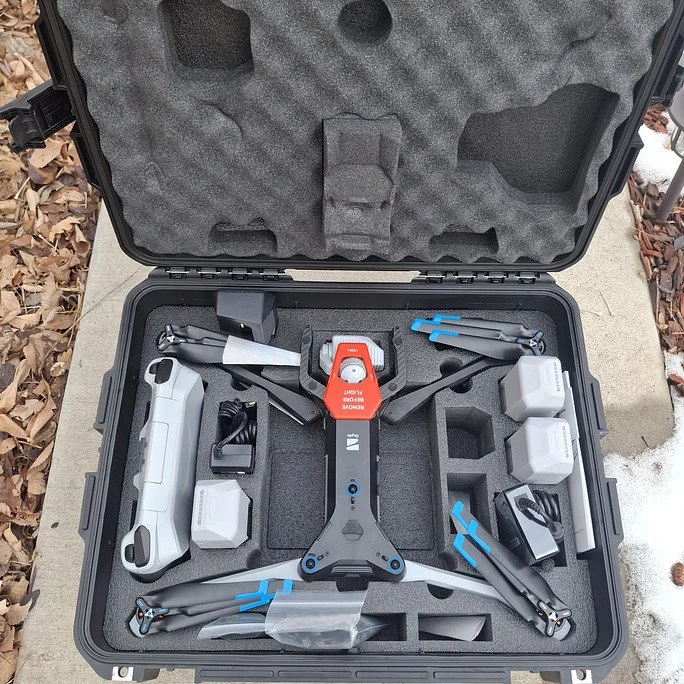
Wingtra Drone for Precision and Performance
With Wingtra Drones, we offer high-end aerial imaging, automatic flight planning, and advanced statistical accuracy for industries such as production, agriculture, and infrastructure development.

Public Safety Drones for Emergency Response
Our Public Safety Drones help first responders with real-time situational recognition, supporting in search-and-rescue missions, fire detection, and disaster management.

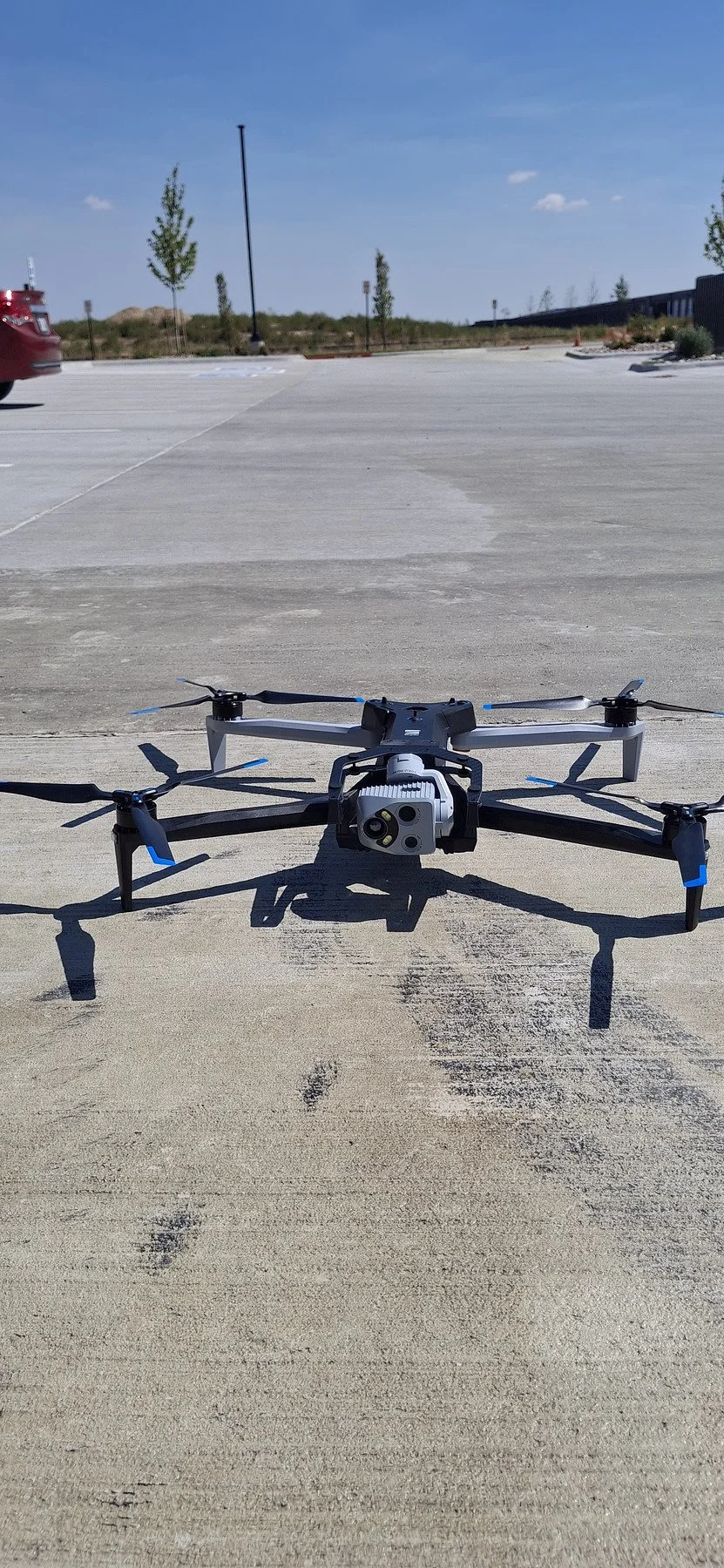
Security Drones for Maximum Protection
Our Security Drones offer real-time monitoring, AI-powered hazard detection, and rapid aerial response, ensuring better safety for organizations, public areas, and vital assets

Drone Mapping for Data-Driven Decisions
Leverage our drone mapping technology for high-decision aerial surveys, 3D modeling, and terrain evaluation, allowing groups to optimize planning and operations.
Transforming Industries with Advanced Drone Solutions
Precision and Performance with Wingtra Drones
Achieve advanced surveying accuracy with Wingtra Drones. These excessive-persistence drones are constructed for massive-scale mapping, turning in topographic records with centimeter-level precision for industries like creation, mining, and agriculture.
Smart Security with Autonomous Surveillance Drones
Enhance security measures with Security Drones that offer real-time monitoring, perimeter control, and AI-powered risk detection. Ideal for law enforcement, important infrastructure, and personal safety, these drones ensure 24/7 safety.
Rapid Response with Public Safety Drones
Why juggle vendors? We handle everything under one roof — hardware, software, aerial capture, data processing, training, and support. One partner. Zero confusion. Maximum efficiency.
Power UP Your Industry with Cleartopia
Leverage Wingtra Drones, Security Drones, and Public Safety Drones to stay ahead in an evolving world.

Frequently Asked Questions
-
The aerial mapping and surveying capabilities of Wingtra drones also include precision agriculture tasks. Through their VTOL (Vertical Take-Off and Landing) system the drones provide accurate aerial surveillance of extensive areas.
-
We provide and support Skydio, Wingtra, and Freefly droSecurity drones achieve improved safety through their capabilities for real-time monitoring and automated patrols and quick response capabilities. The drones possess exceptional speed to scan massive areas as they detect threats through thermal vision sensors and work in unison with security systems for continuous surveillance operationsnes. Each platform is selected depending on project size, type, and environmental complexities to ensure the best results every time.
-
Public safety drones' capabilities enhance police work, firefighting operations, and rescue operations because they enable aerial reporting, thermal detection, and real-time broadcasting features.
Enhance Safety and Precision with Cutting-Edge Drones!
The latest drone technology provides better safety combined with enhanced precision functions. The time has arrived to bring your security alongside mapping and public safety operations into the future through advanced drone technology advancement. Wingtra drones join an array of security and public safety drones that will fulfill your operational needs.
Contact us now and explore the future of aerial innovation today!