
How Does Autonomous Navigation Improve Aerial Survey Results?
Surveying used to be a headache. You’d spend hours manually flying drones, worrying about crashes or missed angles. It was exhausting. Now, autonomous tech has flipped the script. When you use skydio mapping drones, the drone handles the flight path while you handle the mission. It’s not just about cool tech; it’s about getting data that actually makes sense. Precision is the name of the game, and automation takes out the human error that usually ruins a good scan. Let’s look at why autonomous navigation from Cleartopia Solutions is the upgrade your survey workflow desperately needs.
Precision Meets Consistency with Autonomous Navigation
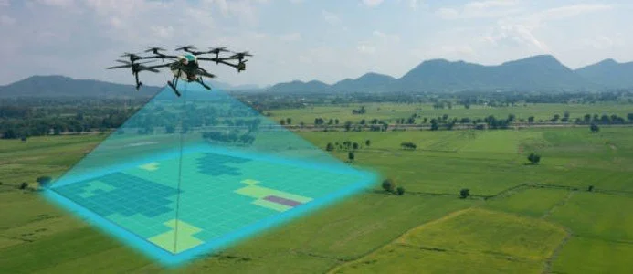
When you rely on a pilot to fly a grid manually, you get variations. One day it’s perfect, the next it’s a bit off. Autonomous systems follow a digital path with robotic focus.
Constant Overlap: The drone maintains a consistent distance from the ground.
Grid Perfection: It follows a strict geometric path without drifting.
Speed Optimization: Algorithms find the shortest route for efficiency and energy savings.
Minimal Re-work: Since the route is perfect, there’s minimal need to re-fly the drone.
This consistency creates a dataset that stitchers love. Software can process these images much faster because the quality remains identical from start to finish. You aren’t fixing bad inputs later in the office.
How Skydio Mapping Drones Simplify Complex Terrain
Flying over flat, open fields is easy. Try flying around jagged cliffs or dense industrial sites, and you’ll sweat. Autonomous navigation changes this by using obstacle avoidance to see where you can’t.
Real-time sensing: The drone maps its environment while it flies.
Dynamic path planning: It adjusts if it sees a tree or tower.
Confidence in the field: Pilots don’t have to stress about collisions.
High-detail capture: It can hug the terrain closely to get crisp shots.
Using skydio mapping drones in tight spaces turns a dangerous job into a routine one. You aren’t just getting pictures; you are getting a reliable 3D model.
Ready to upgrade but not sure where to start?
Talk to a Geospatial Expert
Scaling Up: From ISR Drones to Routine Mapping
The tech isn't just for surveyors. It has bled into other sectors. Whether it is ISR Drones for monitoring or specialized Security Drones, the goal is the same: gathering reliable intel.
Automation: Takes the load off the operator during long shifts.
Safety: Keeps your UAS Hardware far from potential impact zones.
Integration: Systems now talk directly to mapping data software.
Speed: You get actionable data from the field to the cloud faster.
This shift helps Public Safety Drones and Police Drones act faster when every second counts. If the flight is automated, the human can focus on what the sensor is actually seeing.
Streamlining Aerial Mapping Workflow
Good surveys require more than just a drone in the air. You need Aerial Mapping workflows that don't fall apart when you hit a bump. Autonomous navigation acts as the glue for your entire data pipeline.
Integrated planning: Define the zone, hit go, and let it rip.
Battery Management: It automatically returns when there is low power.
Predictability: You always know how much time a flight will take.
Data integrity: Your mapping and data services become more reliable.
When you offer data mapping services, your reputation relies on the quality of your output. Automation ensures that the output is solid every single time, which builds massive trust with your clients.
Why Quality Data Matters for Your Bottom Line
At the end of the day, you are selling information, not just flight time. If your data is messy, your client loses money. Automation is the best way to clean up your process.
In fact, by doing it the right way, right from the start, you will save money in terms of man-hours, transportation costs, and processing time. It is not an extra cost to use technologies like the Skydio mapping drones; rather, it is investing in doing it right.
Need a partner to help you build?
Schedule a Consultation with Cleartopia
Partnering with Cleartopia Solutions
At Cleartopia Solutions, we’ve seen the industry evolve firsthand. We realize that having the proper hardware alone will not suffice. You require a partner who is well-versed in the software, process, and regulation aspects of it all. We assist you in selecting the proper software and building a scalable system that can help you grow. It does not matter whether you are expanding your fleet or just beginning; we can provide you with the necessary expertise for your autonomous surveying needs.
Conclusion
Autonomous navigation is not something that lies in the future; it is now the accepted norm. The use of autonomous navigation means that the software takes care of the flight for you, eliminating any uncertainties and human mistakes in the process. This means that your data will be better, your flight will be safer, and your finances will start looking much better.
FAQ’s
1. Does Cleartopia Solutions offer support for choosing the right drone?
Yes, Cleartopia Solutions helps you select the perfect hardware for your specific project. Your requirements will be assessed, and the best technology, even the most advanced technology, will be recommended to make sure that your mapping and data services are effective and generate professional results every time.
2. Why is autonomous flight better for aerial surveys?
Autonomous flight provides the required overlap and correct flight path that is necessary for good 3D modeling. It eliminates any chances of human error, provides a constant ground sampling distance and makes sure the drone can overcome all the hurdles easily.
3. Does this tech work for industries outside of surveying?
Absolutely. Autonomous navigation is widely used in sectors like public safety, security, and industrial inspection. It allows for reliable data collection in dangerous or difficult-to-reach areas, ensuring that teams can focus on analyzing the captured information rather than manually piloting the aircraft during complex missions.
4. How does autonomous navigation affect my post-processing time?
Because autonomous flights follow perfect grids, your images have consistent metadata and overlap. This drastically reduces the time your software spends "thinking" to stitch the data together. You spend less time fixing errors and more time delivering finished, accurate maps to your clients.
5. Is it difficult to learn how to use autonomous drone software?
While there is a learning curve, modern interfaces are built to be intuitive. Most autonomous systems allow you to set boundaries on a tablet and let the drone take over. With the right training, your team can become proficient in these workflows in a very short time.
