
How Is Drone Mapping Changing Construction and Real Estate?
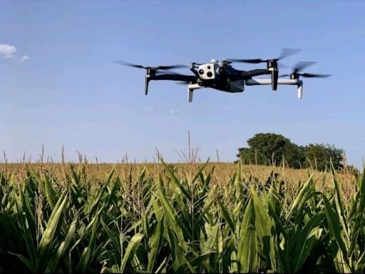
Construction and real estate are moving faster than ever. Clients want updates quickly, developers want accurate site data, and buyers expect better property visuals before making decisions. That is where an aerial mapping drone is changing the game.Instead of depending on slow manual inspections, companies can now capture detailed site information in minutes. Drone mapping helps teams track progress, improve planning, and avoid costly mistakes early. It also makes property marketing far more engaging for buyers. The best part is that this technology is no longer limited to huge corporations. Even smaller construction and real estate businesses are starting to use drones as part of their daily workflow.
Why Construction Teams Are Using Drones More Often
Traditional site inspections can be frustrating. Workers spend hours walking large properties, taking measurements, and checking progress manually. It slows projects down and leaves room for mistakes.
Drone technology makes that process much easier. Teams can quickly capture high-quality visuals without interrupting work on the ground. Modern aerial view maps also give project managers a clear understanding of the entire site from one perspective.
That means fewer blind spots and faster decisions.
Managers can identify drainage issues, missing materials, or unfinished work before those problems become expensive delays. On large projects, this saves serious time.
Better Land Analysis Before Construction Starts
Developers often face problems because they do not fully understand a property before construction begins. Slopes, access roads, elevation changes, and nearby structures all affect planning.
Detailed aerial maps help developers study land conditions before making major investments. Instead of relying on outdated images or rough estimates, they can review current site visuals with far better accuracy.
This also improves communication with investors and clients because everyone can clearly see the property layout from the beginning.
Faster Measurements With Better Accuracy
Accurate measurements matter in every construction project. Small mistakes lead to three types of problems, which include material waste, scheduling difficulties, and unplanned expenses that occur later in the process.
An aerial mapping survey performed by professionals enables teams to obtain measurements at a speed that exceeds what traditional methods can provide. Drones use their capabilities to record site elevation information, boundary details, and terrain features while maintaining continuous operational activities.
That speed helps companies stay organized while improving overall project planning.
Need Faster Site Updates?
Improving Safety on Busy Job Sites
Construction sites present dangerous hazards to workers. The safe access of certain areas becomes challenging when excavation or structural work is underway.
Using a UAV for aerial mapping decreases the need for workers to enter dangerous areas, which they would require to check operational progress. Drone operators can collect visual data safely from above while the crew continues working below.
Fewer dangerous inspections mean fewer accidents and fewer project interruptions. That is a major reason construction companies continue investing in drone technology.
Clearer Communication Between Teams
One common issue in construction is confusion between contractors, project managers, and clients. Everyone wants proof that work is moving forward properly.
This is where drone surveying becomes extremely useful. Teams can compare images from different stages of the project and instantly track progress. Instead of relying only on written reports, they have visual proof showing exactly what changed.
That reduces misunderstandings and keeps everyone aligned.
Turning Images Into Real Project Data
Drone mapping is not only about capturing photos. The real value comes from analyzing the data collected during flights.
Software powered by photogrammetry can turn drone images into detailed digital models. These models help teams calculate stockpile volumes, analyze terrain conditions, and monitor grading accuracy with much better precision.
The process sounds technical, but the benefit is simple. Better information helps teams avoid costly mistakes.
Drones vs Traditional Imaging Methods
For years, developers relied heavily on satellite mapping for land analysis. While satellite images are still useful, they often lack the detail and flexibility needed for active construction projects.
Drones provide fresher visuals, better accuracy, and faster updates whenever teams need them. That level of control makes project management far more efficient compared to older imaging methods.
Smarter Planning Reduces Delays
Construction delays usually start with poor planning. Bad terrain analysis and missed site issues often become expensive problems later.
Tools like 3D terrain modeling help teams understand elevation changes and land conditions before major work begins. That improves excavation planning, drainage management, and infrastructure placement from the start.
Good planning prevents unnecessary setbacks.
Why Every Drone Flight Needs Preparation
Even advanced drone equipment needs proper preparation to deliver accurate results.
Strong flight planning helps operators capture clean data while avoiding weather issues, restricted airspace, and unnecessary risks. Organized flights also improve consistency, which is important for long-term construction tracking and reporting.
Preparation plays a huge role in successful drone operations.
How Cleartopia Solutions Supports Modern Projects
At Cleartopia Solutions, we work with businesses that want faster reporting, better site visibility, and more accurate project data. The aerial mapping drone we tested proved its ability to streamline inspections while enhancing planning processes and enabling construction teams to make more effective decisions without causing project delays.
Our organization aims to assist businesses in implementing practical drone technology solutions that will enhance their daily operations while maintaining organized project workflows.
Conclusion
Modern construction and real estate work now use drone mapping as a standard operational method. The system provides various benefits because it helps organizations save time while enhancing their ability to communicate and work more safely and make improvements through better decision-making.
Companies that adopt this technology at an early stage will finish their projects more quickly while avoiding many delays, which typically affect traditional work processes. Drone mapping technology will become increasingly important to builders, developers, and property professionals as the industry keeps progressing.
Ready to Map Smarter?
FAQs
Q. How does Cleartopia Solutions help with drone mapping projects?
Cleartopia Solutions helps construction and real estate businesses capture accurate site visuals, monitor project progress, and improve planning through drone technology. The company develops practical solutions that enable teams to reduce manual inspections while achieving faster reporting and better decision-making capabilities to maintain project organization throughout all development stages.
Q. Why are drones useful in real estate marketing?
Drones help buyers understand property layouts, nearby infrastructure, and land positioning before visiting a location. Aerial visuals also make listings more engaging online because they provide a wider perspective compared to regular photos. This helps real estate businesses attract more attention while presenting properties in a more professional and informative way.
Q. Can drone mapping improve construction safety?
Yes, drone mapping improves safety by reducing the need for workers to inspect dangerous areas manually. Operators can collect accurate visual data from above while crews continue working safely on the ground. This lowers accident risks, reduces unnecessary site exposure, and helps construction teams complete inspections without interrupting ongoing operations.
Q. Is drone mapping expensive for smaller companies?
Drone mapping has become far more affordable than many businesses expect. Smaller contractors and local developers now use drone services to improve planning, inspections, and property marketing without major investment costs. Because drones save time and reduce mistakes, many companies see long-term value even when working on smaller construction or real estate projects.Construction and real estate are moving faster than ever. Clients want updates quickly, developers want accurate site data, and buyers expect better property visuals before making decisions. That is where an aerial mapping drone is changing the game.