

Freefly drone sales, support, training and advisory
Freefly Systems builds American-made, Blue UAS certified industrial drones. Cleartopia helps teams choose the right Freefly platform and payload for mapping, inspection and specialty sensor work.
Trusted by teams at







The Freefly lineup
Specifications and availability are set by the manufacturer and can change. We confirm current models, payloads and pricing when we scope your project.
Freefly Astro Max
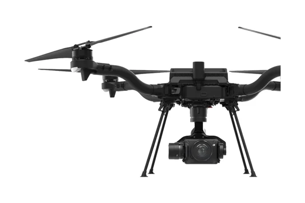
Freefly's compact industrial drone puts large 21-inch props on a 14-inch body, which gives it long, quiet and very stable flights. The mapping configuration pairs a 61 MP Sony LR1 on a stabilized gimbal with 24, 35, 50 or 75 mm lenses, and thermal or a laser rangefinder can be added in minutes. RTK holds position to centimeter level for repeatable capture.
Payloads mount on Freefly's Smart Dovetail, an open interface with more than 16 ready-to-fly options, from LiDAR (Flux, Emesent Hovermap, YellowScan) to multispectral, gas detection and EO/IR cameras. An onboard Skynode mission computer adds LTE cloud connectivity and Auterion fleet management, and hot-swappable SL8 batteries keep crews flying between sorties.
Key specs: Up to 28 min with LR1 · 61 MP mapping camera · 220+ acres at 2 cm GSD per flight · Hot-swap batteries · Blue UAS · NDAA compliant · Made in USA
Freefly Alta X Gen2
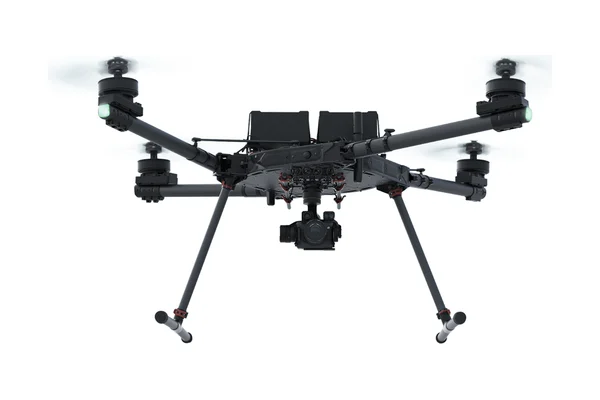
Freefly's heavy-lift workhorse for payloads too large for Astro: long-range LiDAR, large-format cameras, hyperspectral imagers, cargo release and line pulling. 33-inch folding props with Freefly's ActiveBlade design cut vibration to about a fifth of normal for cleaner data, and the airframe folds to half its size for transport.
Every Gen2 ships with dual F9P GPS with GPS heading, an industrial IMU, LTE, an FPV camera and a laser rangefinder, plus Ethernet and 12V/24V power for payloads. It shares Smart Dovetail payloads and the Pilot Pro controller with Astro, so teams can move between the two aircraft without relearning the system.
Key specs: 40 min with no payload · 17 min at max payload · Up to 33 lb (15 kg) payload · -4 to 122°F · IP43 equivalent · NDAA compliant
Freefly Flux LiDAR
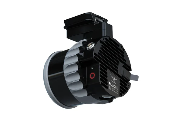
Freefly's in-house LiDAR family for Astro and Alta X, built around a fast field workflow: no calibration passes, press record, fly the mission, then process the point cloud on an iPad while still on site. Each unit combines the scanner with low-noise IMUs, dual GNSS and a 20 MP camera for colorization.
Three versions cover different jobs: Flux H1 (Hesai XT-32MX, 300 m range, triple returns), Flux O1 (NDAA-compliant Ouster OS1 with 128 channels) and the entry-level Flux L1, whose non-repetitive scan pattern suits power lines and other hard-to-capture features.
Key specs: ±3 to 5 cm accuracy · Up to 1.9M points/sec · 663 to 715 g · On-site processing on iPad
Freefly Pilot Pro
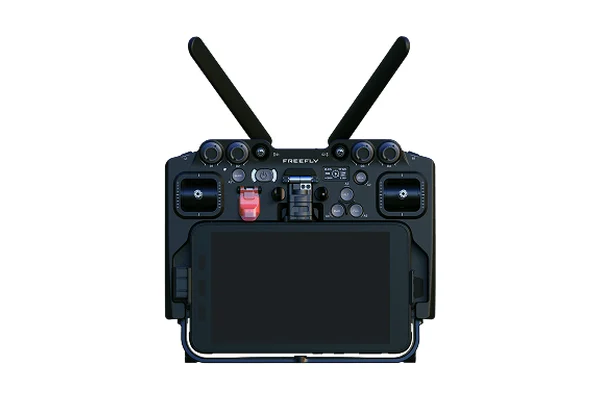
Freefly's handheld ground controller, machined from aerospace-grade aluminum, with dedicated controls for every key drone and gimbal command so pilots work without digging through menus. Velocity clamps let operators cruise to a site at speed, then slow right down for precise positioning during inspection.
An internal battery plus hot-swap external batteries keep it running all day, and redundant screens and a redundant kill switch add safety margin. It controls Astro, Alta X and Freefly Mōvi gimbals, and Freefly publishes CAD and an API for custom integrations.
Key specs: 5 hr internal runtime · 1 hr charge · Hot-swap batteries · 14 to 122°F operating range
Where Freefly fits
Freefly platforms are built for lifting serious payloads with precise control. They are a strong fit when a program needs high-resolution mapping cameras, LiDAR or specialty sensors, and when NDAA compliance and Blue UAS certification are requirements rather than preferences.
Common uses
- High-resolution photogrammetry and mapping
- LiDAR mapping and on-site scanning
- Carrying specialty and third-party payloads
- Government and compliance-sensitive programs
How Cleartopia helps
We match the airframe and payload to your deliverable, then plan the positioning, processing and training around it so the system produces usable data from day one.
Next step